photos of direect relatives of Larry Lachance
Large oak tree Lachance.org Logo
l'Île d'Orléans from a Lachance Point of View (Paintings by Cathy Lachance)
What better way to introduce the ancestral home of our Lachance family than to highlight one of our most talented cousins.  Cathy Lachance is an artist who loves painting nature and she lives on the Island where she finds inspiration all around.  Two of Cathy’s paintings are combined above  "Au bout de l'île" and “Vignoble Isle de Bacchus”. The latter translates to "Isle of Bacchus Vineyard".  As Jacques Cartier originally named the island, the name lives on in both the painting and the actual vineyard located in Saint-Pierre.

Cathy's family has been a part of the island for, literally, hundreds of years... her works, more of which may be seen on her website, truly represent the beauty of the island that is the birthplace of our grand Lachance family.  Visit Cathy's website by clicking on her "Lachance" logo.  And, most important, thank you Cathy for allowing me to use your work on our family website.
Link to Cathy Lachance - Artist of l'Île d'Orléans
www.cathylachance.com
Remembering - André Côme Lachance (1933-2018)
Some content on this page was written and contributed by Rita Hubert and her husband, Côme Lachance more than 18 years ago.  (Côme was a direct descendent of Pierre Noël Pépin dit Lachance and his marriage to Charlotte Rondeau). Rita also graciously provided the two "plaque" photos on this page. I will always be grateful to Rita and Côme for helping all of us to learn more about the place from "whence we came"
A lot of information about the history of l'Île d'Orléans is available on the internet as well as other published sources.  One of the most complete histories that I've seen is the book, "Isle of Orleans" (see image), sometimes available as a reprint from Quintin Publications and Abe Books as well as on EBay.  If you are interested in the historical detail of the island, I will recommend this book as it is very informative.  Current pricing (2018) ranges from about $24 to over $100 depending on the seller. 
And so it begins...on January 15th, 1636, the Company of New France granted to Jacques Castillon, burgher of the city of Paris, "the Island of Orleans, situated in the river St. Lawrence, in New France, to be enjoyed by the said Sieur Castillon, his successors or assigns, in full possession, law and entail..."
The seigneurie was conceded to him jointly with 7 others:  François Fouquet, Charles de Lauzon, Jacques Berruyer, Jean Rose, Jacques Duhamel, Noël Juchereau, and Antoine Cheffault. They left the land practically uncultivated for nearly a quarter of a century.  It's around this time that our Antoine buys his land in 1659.
Isle of Orleans - Book by Pierre Georges Roy
It is from this book that we learn it was Jacques Cartier who makes the first mention of the Island during his second voyage to New France in September of 1635. 
l'Île d'Orléans and
Antoine Pépin dit Lachance
TIMELINE
1650 - Permanent settlement of French immigrants established.
1652 - Antoine Arrives in New France
1655 - Antoine acquires land at Lauzon and Coulonge
1659 -Antoine buys the land at l'Île d'Orléans and thus becomes one of the original founding families of the island
1659 - Antoine marries Marie Teste at Notre-Dame in Québec
1661 - Ste-Famille Established
1666 - First Census of Quebec - Antoine is counted among the 100 married families
1669 - Construction of the first church in Sainte-Famille began in 1669 under the direction of Bishop François de Laval.
1676 - l'Île d’Orléans becomes a county divided into four burgs: Saint-Pierre, Saint-Jean, Sainte-Famille and Saint-Paul (renamed Saint-Laurent in 1698).
Quebec Fleur de Lis
THE HISTORY OF ÎLE D'ORLÉANS
L'Île D'Orléans and the Saint Lawrence River would be discovered by French explorer and mariner Jacques Cartier.  While at anchor off the coast of the island from the 7th - 14th of September 1535, Cartier decided to make an search of the island that the indigenous Huron called "Minigo", meaning the "enchanted island".  Other sources claim the native Indians called it "Ouindige", an Algonquin word which means "Bewitched Place". Either way, when Cartier visited, he gave it the name... "Island of Bacchus".  He found this appropriate because of the profusion of wild grapes growing there.  During his second voyage, 1535-36, (he spent the winter near present day Quebec City), Cartier renamed it the Ile d’Orléans in honor of the Duke d’Orléans, the son of French king, François I.  For the next 100 years the island would be a part of the Beaupre Seigneurial domain. (click for more)

Following the grant to Jacques Castillon, it was then subjugated to the Bishop of Quebec Francois Montmorency, then to Francois Berthelot and finally to Guillaume Gaillard and his descendants.  The Seigneur's role was to grant land.  As of 1651, the residents were granted fiefs and sub-fiefs, which they settled on and cultivated.  By 1685 the Census recorded 1205 residents and 917 heads of cattle.  Most of the colonists chose to settle just above the northern arm of the St Lawrence where they were sheltered by the cliffs near St-Pierre and Ste-Famille.  The colonists then spread throughout the island with
the Lachance family mainly congregating in St Jean (see map). The island was occupied by English General James Wolfe in 1759. This conquest was short-lived and no trace of this occupation remains.

The colonists had to be self-sufficient because they were
*cut off from the rest of the world. They became fisherman, blacksmiths, carpenters, saddlers, tanners, shipbuilders and captains. The farmers sowed flax to weave into linen for clothing, wheat for flour and grains for cattle feed. Windmills and watermills were built to help with the grinding of flour.

The land was divided into long strips perpendicular to the shore.  These parcels of land continue inland until they reach the “trecarre”.  The “trecarre” is the line separating northern and southern lots.  The island farmers were subject to Seigneurial law until 1854, which dictated that the land would be used to cultivate sustenance foods.  The farmers started to produce specialized crops once the Quebec City markets created a demand for it.  Today the main crops are oats, hay, potatoes and strawberries.  Today’s farms are operated as a specialized business.
Canadian Museum of History Logo and link to
One of the best resources for the history of, not just l'Île d'Orléans, but all of New France is the Canadian Museum of History - Virtual Museum of New France.  Click the logo to visit..
typical street, houses with colored roofs, St-Jean - Chemin Royale
Chemin Royale - St-Jean (2001)
Click to view full size
Architecture on the island has a 350-year-old history.  Many of the buildings have been deemed of great historical value.  The first houses were patterned after the French houses that they were familiar with in France.  The houses were small and centred around a fireplace that was used both for heat and cooking.  They were built of wood with thatched roofs.  As time passed they designed houses that were larger and more adapted to the weather conditions.  Villages tended to expand length wise following the contours of the shore.  Houses were mostly built along the Chemin Royal close to one another in the villages and became less frequent between towns.  The main attraction in town was the church and rectory with the cemetery as an important part of the parish landscape.  The importance of the church in their lives is signified by the ornate interior of those churches.

The words "*
cut off" takes on new meaning when you find out that until 1940, the island was accessible only by boat in the summer and by ice bridges in the winter. The completion of the Pont de l'ile -- the Bridge of the Island -- made access easier, but the island's little communities have remained largely rural and picturesquely Québeçois in style.
collage of paintings showing ships and settlers on  the st. lawrence river in the 1600's
From  "Isle of Orleans" by Pierre George Roy
we find the following:
"No part of the Province of Quebec is more picturesque than the Island of Orleans.

Authors have written its history, poets have sung its charm and painters have reproduced its lovely landscapes.  Indeed, this spot seems to typify the splendor of Canadian scenery.  Its cool groves, its colorful meadows, the fringe of trees which surround it recall the intense vegetation of the tropics.

Nothing is prettier to behold than the little brooks which meander with a silvery gleam through the fields and bubble down to the river."  
This is where our ancestor Antoine found his home! From this tiny island and humble beginnings, Our Pépin dit Lachance Family, became established permanently in this hemisphere.
L'Île d'Orléans has a jagged coast line with many coves and points that extend into the St Lawrence River.  Viewing the island from the mainland, it rises from the water in a gentle incline, showing only its valleys and low ridges.  The island has a temperate climate, that is influenced by the surrounding St. Lawrence.

This river, one of the longest in North America, flows in a north-easterly direction, connecting the Great Lakes with the Atlantic Ocean and forming the primary drainage outflow of the Great Lakes Basin. The amount of water flowing in the river causes the island to experience the ebbs and flows of the tide.
Links to maps of Ile d'Orleans
A map of the l'Île d'Orléans that shows the locations of each of the parishes appears below.

If you
click on the map a new map opens showing the full size image with a list of where our ancestors settled. You may have to scroll left and right to view the entire map. Simply close the map window when you have finished.

A third, very large, map is available that is a reproduction of a 1689 map of the island.  Look closely for the number 10 in a circle to find Antoine. Click "Ancestor Map" Here to open this map. (
opens in a new browser window or tab)
Large map of Ile d'Orleans showing parish and Lachance locations
The Island Logo in a circle
L'Île-d'Orléans is an island in the Saint Lawrence River just east of Quebec City. It is, today, a regional county municipality in the Capitale-Nationale region. Its seat is Sainte-Famille, the first parish. The population in the 2016 census was 7,082 persons.  See for yourself, Ste-Famille, on the island is located at Latitude: 46° 57' 59.99" N, Longitude: -70° 56' 59.99" W. Click to open. (opens in a new browser window or tab)

The island is 34 kilometres (21.25 miles) long and 8 kilometres (5 miles) wide and has a land area of 192.81 km2 (74.44 sq mi). Currently, there are 3,470 dwellings on the island.  The Chemin Royal, the 68-kilometre "Royal Road" that circles the island and takes you through the six parishes on the island. (
described below)

The weather includes long, cold and harsh winters with at least three months of below freezing (0°C - 32ºF). Snow can begin in October and end sometime around March; then the rains come but it's still cold.  There is an abundance of wildlife, the land is fertile and today, you can reach the island by car without the worry of being attacked by a band of unfriendly Iroquois!
 
Pioneers Early Life - painting of Pioneer family at home
Imagine, the word and the song by John Lennon
Imagine no possessions
I wonder if you can
No need for greed or hunger
A brotherhood of man
Imagine all the people sharing all the world...
John Lennon - 1971
Can you imagine?  Imagine being around 20 years old TODAY!  Are you young enough to imagine life without access to a computer let alone facebook or games?  Or perhaps you are a resident of Florida in the US, can you imagine life without air conditioning?  How about without electricity or cars as a way of getting around?

Ok, you get my point...now close your eyes and picture yourself sitting in the only room in your house (that YOU built), your feet are cold because the floor is made out of dirt and you are trying to play a game with your children by candlelight while you take in the warmth coming from your fireplace in the middle of the room over which your dinner was just prepared...  Your thoughts turn to tomorrow, another day... you must be awake, fully clothed, with everything you've got that's warm, and ready to head outside to milk the cow and gather eggs for breakfast and the sun is not even up yet... You have nothing more than a day of work so that you can make it another day!

There is no 7-11 in case your forgot the bread (of course you had to make your own), there is no such thing as a grocery store (everything you ate came from the crops you grew or the meat you hunted and prepared), you can't go buy warm woolen socks down at Target (your wife or mother made all of your clothes for you) and you can't even get to the city until the river is frozen over so you can walk the 15 or so miles to get there. 

I cannot imagine...all of this and you have to worry about protecting yourself and your family from hostile Indian attacks too!  Can you imagine what your life may have been like in these difficult times?
Certainly it is difficult in any attempt to reconstruct the life of anybody who lived more than 400 years ago.  It is virtually impossible to imagine a life in a time and place so different from our own.  It is impossible to know what our ancestors were thinking or feeling or what they hoped for or dreamed of.  All we can really do is speculate based on know facts of the times.  It is then we begin to comprehend just how much was endured in times past...so that we can read this today!
We do believe that most settlers at the time arrived in hopes of finding a better life, if not something more.  Wealth of the day was found in the furs that were traded and the abundant fishing the provided a means to survive but not wealth in the truest sense of the word.
We must assume that life was tremendously difficult for the French men and women who settled along the St. Lawrence River in the seventeenth century.  It took stamina, courage, and perseverance, along with a measure of good fortune, just to stay alive in the early years of this new colony. 

The women who settled in Quebec at that time married young and had large families.  Historians tell us that there were altogether only about one thousand married women living in Quebec between 1608 and 1680; fifty years later these women has produced fifty thousand descendants.
From the Hébert family history we read that Joseph Hébert the grandson of of Louis Hébert and Marie Rolet married Marie-Charlotte de Poytiers or Poithier or de Poithier  on Oct 12, 1660. 

Not long afterwards he was captured by the Iroquois, perhaps by the same band who killed his cousin Nicolas Couillard and six other Frenchmen on the Île d’Orléans in June 1661.

A letter written by a companion in captivity states that, wounded in the arm and shoulder, he was given to the Iroquois of Oneida. After the usual tortures, he was finally stabbed to death by drunken members of the tribe. His death was not definitely known in Quebec until the summer of 1662.
Pierre LEVASSEUR, dit L’Espérance built a house and outbuildings on a piece of land belonging to the Argentenay seigneury, on the Île d’Orléans;

During this time an epidemic broke out among the Indians. For six whole months the Hospitallers were attending so many smallpox victims that huge bark lodges were set up around the nuns’ shelter to receive them.
From - thecanadianencyclopedia.com

"As each new area of Canada was opened to European settlement, pioneers faced the difficult task of building homes and communities from the ground up. Pioneer life revolved around providing the basic necessities of existence in a northern wilderness - food, shelter, fuel and clothing."
thecanadianencyclopedia.com - (cont'd)

"For most, however - especially before roads, canals and railways provided communication and transportation of goods - pioneering on all of Canada's frontiers meant isolation, deprivation and hardship.
Success was often measured by sheer survival.

Yet, usually within a few years, primitive pioneering was followed by relative comfort, and the prospect of security and even prosperity for one's children.  Persistence, optimism, thrift, resourcefulness and the acceptance of unremitting hard work became character traits valued by succeeding generations long after pioneer conditions had passed.

Providing fuel for the huge fireplaces, which were usually the dwelling's only source of heat, was a constant chore. Timber was plentiful in many areas but still had to be felled, trimmed, cut into lengths and carried home.

Women's work was essential to the comfort and long-term success of a farm operation.  Pioneer women worked tirelessly for their family's material and cultural betterment.

Although they suffered loneliness and hardship, the women’s courage and strength gave them a place of respect in Canadian life."
POSSIBLE CONTINUED READING
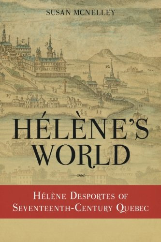
A book, written by Susan McNelley, called "Hélènes World" is the only published work I know of that manages to weave together the life of the pioneer with the circumstances at the time. This book presents a rare insight into the life of an "ordinary" woman living through extraordinary times!

This is the life of Hélène Desportes who many of us are descended from.  She was the wife of Guillaume Hébert and, obviously ONE TOUGH LADY! She is also my 9th great-grandmother.  If you are interested, the book is currently available from Amazon - click on the book to find it.
Hélène Desportes of Seventeenth-Century Quebec
Parish Seals for each of the parishes on L'Île-d'Orléans
Photos below, aside from Sainte-Famille and Saint-François which were taken by me in 2001, have been found on various websites.  Much more information about the churches and the parishes themselves can be found using assorted searches on the internet today. One, particularly good source, is  L'île d'Orléans tourism website.  Click HERE to visit. Below you will find the basics including the last known address and phone number for each church.
photo of the church at Ste-Famille
Sainte-Famille

Area : 17.92 Sq. Miles
Population - 1996 : 913 inhabitants
Population - 2016 : 938 inhabitants
Founding of the Parish : 1661
3945, chemin Royal  
Sainte-Famille (Québec) G0A 3P0
(418) 829-2209

The first parish on Ile d'Orléans was established in 1661 and construction on the first church began in 1669.  In 1734, Abbot Joseph Dufrost was given the mandate to build what would be the current church. Today, this building is the oldest two-steeple church in Canada, and the only church in Quebec with three bell towers at the front of the building.  Sainte-Famille has a view of Sainte-Anne-de-Beaupre and the Laurentian Mountains. Being the oldest parish in the village it has several stone houses dating from the French Regime.  Facing the church is the famous Notre Dame Convent founded by Marguerite Bourgeoys.  The industry in this area is mostly dairy and beef farms, and apple orchards.
On June 24, 1659, Antoine Pepin dit Lachance bought a farm of 2 "arpents"(73,604 square feet) number 28B, which was very close to the Ste-Famille church. Today the land numbers are 3990-4019.  This land was later subdivided into town lots.
photo of the church at St-Pierre
Saint-Pierre

Area : 12.02 Sq. Miles
Population - 1996 : 1982 inhabitants
Population - 2016 : 1993 inhabitants
Founding of the Parish : 1673
1243, chemin Royal  
Saint-Pierre (Québec) G0A 4E0
(418) 828-2656

Saint-Pierre was founded in 1673. Saint-Pierre has the oldest church in the province of Quebec dating back to 1717. It is possible that it may be the oldest church in Canada. Construction on the first church in Saint-Pierre, built in half-timber and covered in shingles, began in 1673 and finished in 1676. Damaged not long after its completion, the church was replaced by a stone building in 1717 that was later designated a historical monument in 1958. In 1955, a more modern church was built next to the older house of worship. This area was known for traditional industries such as blacksmiths, tinsmiths, and butter and cheese production. The area presently has dairy farms, and the agricultural cultivation of potatoes, corn and strawberries.
Saint-Pierre is the closest village to the bridge linking the Island to Quebec City. This has increased the population of this area. A main attraction for this parish is the thousands of snow geese, Canada geese and several species of ducks.
photo of the church at St-Jean
Saint-Jean

Area : 16.85 Sq. Miles
Population - 1996 : 847 inhabitants
Population - 2016 : 1059 inhabitants
Founding of the Parish : 1675
2001, chemin Royal  
Saint-Jean (Québec) G0A 3W0
(418) 829-3182

The first church in Saint-Jean was built in 1675. It was replaced by the existing church in 1734. The church was built with a walled cemetery overlooking the St-Lawrence River. The farms in this parish run south to north to the middle of the island making the farms 4 kilometers long. These farms border on the Sainte-Famille parish farms in the middle of the island at the "trécarré".  Saint-Jean was considered the island capitol because of several prosperous dairy, potato and strawberry farmers, numerous navigators and several summer residents. It lost its status when the bridge to Québec City was built in 1935.  Saint-Jean is home to the Mauvide-Genest Manor, a rare and exceptional example of French seigneurial past and one of the oldest remaining manor houses in Quebec.
Saint-Jean is where most of the Lachance family settled.
photo of the church at St-Laurent
Saint-Laurent

Area : 13.64 Sq. Miles
Population - 1996 : 1576 inhabitants
Population - 2016 : 1532 inhabitants
Founding of the Parish : 1675
1532, chemin Royal  
Saint-Laurent (Québec) G0A 3Z0
(418) 828-2551

The Saint-Laurent parish was founded in 1675. A chapel was raised in Saint-Laurent in 1675, but it wasn’t until 1697 that a church and presbytery were built in the village on land donated by Seigneur Berthelot. The church was expanded in 1702 and demolished in 1864. The community’s second church, built in 1860, still stands today. This parish is renowned for its maritime activities. It had a shipyard and was famous for building "chaloupes" a long rowing boat. Moreover, some 15 shipyards were building up to 400 rowboats, coasters, and schooners a year. This is also where you will find the Processional chapel. Today, the main attraction is the Parc Maritime de Saint-Laurent. The park preserves the maritime heritage, featuring exhibits and guided tours at the former Saint-Laurent Ltd. shipyard.
photo of the church at St-François
Saint-François

Area : 11.87 Sq. Miles
Population - 1996 : 484 inhabitants
Population - 2016 : 527 inhabitants
Founding of the Parish : 1678
341, chemin Royal  
Saint-François (Québec) G0A 3S0
(418) 829-3440

The first two churches in Saint-François were made of wood, the first dating back to 1678, and the second to 1707. Today, there is a cemetery where once stood these houses of worship. Construction of the first stone church lasted from 1734 to 1736. A car crashed into the church in 1988, killing two people, and the ensuing fire destroyed the inside of the building. The current church was built in 1991.  The parish is located at the eastern end of the Island with its farms stretching from north to south. The farmers here principally produce strawberries, leeks and potatoes. This area is also famous for duck, snow geese and Canada geese hunting. The observation tower allows a magnificent view of Montmagny, Mont Sainte-Anne and Cap Tourmente.
photo of the church at Ste-Pétronille
Sainte-Pétronille

Area : 1.74 Sq. Miles
Population - 1996 : 1090 inhabitants
Population - 2016 : 1033 inhabitants
Founding of the Parish : 1870
21, chemin de l'Église  
Sainte-Pétronille (Québec) G0A 4C0
(418) 828-2656

Originally named Sainte-Pétronille de Beaulieu, it was the last parish to be founded in 1870 with the church was built in 1871. It is locally known as the "end of the island" and is situated at the western end . In the 1800's Québec City merchants built magnificent "Regency" style homes that are to this day part of the landscape along Chemin Royal.

The topography, not well-suited for agriculture, resulted in the parish becoming a popular summer resort for wealthy residents of Québec City by the mid 19th century. Hundreds of day trippers travelled to Sainte-Pétronille by ferry for a Sunday stroll. In 1868, it became home to North America's first golf course, a three-hole course.  As a result of this posterity a Victorian style hotel "Chateau Belair" was built. This part of the island also has" Boreal Oak Grove" in which grows North America's rare red oaks.
banner for Lachance memorials
The Lachance Family
Of special interest to the Lachance Family is a plaque, that commemorates our family, mounted on the front wall of the church at St-Jean Île d'Orléans. 
My loose translation is:
In honor of the Lachance family who in memory of their ancestors established on the island of Orleans erected at the (religious) establishment the parish of Saint Jean in the year 1679.
Memorial to the Lachance Family of Île d'Orléans at St-Jean
Click Image to Enlarge
Barthélemy Lachance
To the descendants of Barthélemy Pépin dit Lachance a plaque inside Saint-Jean church that identifies Barthélemy, his wife Marie-Anne Thivierge and his daughter-in-law Geneviève Paquet as being buried in the church nave. 

This is considered a great honor because this is normally a privilege reserved only for priests.
Interrment of Barthélemy Pépin dit Lachance
Click Image to Enlarge
my personal thoughts cloud
I have visited the island twice in my lifetime...I desperately want to return!  The beauty of the island is everything you hear and read about and more.  It wasn't long, walking on the grounds of the Ste-Famille church, that something clicked inside.  Maybe just my imagination but it sure felt like a deep sensation of belonging with an overwhelming feeling of peace, as if I'd just returned home from a long journey.  If you can trace your family to the island and you don't already live there, I won't hesitate to tell you to make this journey and experience it for yourself.
Return To Previous PageReturn To Previous Page
Presented by
Larry Lachance
Any Commercial, religious, or other use, without the consent of the compiler  (Larry Lachance) is prohibited!
If you use information or data from this site, you must give proper acknowledgement and credit. 
Contact me with your comments and corrections.
Copying expressly forbidden except for your PERSONAL (not-for-profit/non-commercial) Family History/Genealogy.